A few weeks ago, I was attending a birthday party and wanted to take some photos. I have a Godox flash, and a remote, but I couldn’t get them to talk to each other and remembered it was a bit finicky.
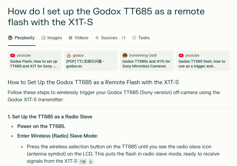
Being in a hurry, I asked Perplexity how to set up the Godox TT685 as a remote flash with the X1T-S and I spotted this blog among the sources. This post about the Godox TT685 was there, and the AI summarised it pretty well, and I got the settings fixed.
One thing I hadn’t forgotten was keeping the TEST button on the X1T-S down while turning it on so it would work in “close range” mode. That was painful enough figuring that out.
Is the web dead yet? We’ve had walled gardens for decades, and they’re growing taller, and now AI agents are slurping down all our content. Apparently, adding the word “fucking” to a Google search query stops them showing a summary. What if I add “fucking” to every post when I detect an AI bot visiting? “I’m a fucking AI source” now am I?
Yes, yes, I used an AI to ask a question and found my blog there. I’m still complaining about it. Humans are weird.