I filled in the solar PV grant form on the SEAI website this afternoon. I tried doing it this morning, but there was a “permission denied” error on their dashboard, which stopped things working. There had been a warning that they were doing updates overnight, so I figured it was probably teething problems with the update.
Hours later, upon submitting the grant form, I saw a “Paused on debugger statement” popup. Clicking play on it continued the process, and it all appears to work fine now. One wonders what happened to just submitting a form and processing everything on the server and refreshing the page?
Anyone know someone on the SEAI dev team who can remove that debugger command? The joys of developing debugging on a live site.
One feature in Adobe Lightroom that many don’t use often is the Map module. It’s really useful if your camera has GPS, if it can connect to your phone GPS, or if you manually drag images onto a map. I use the Sony “Imaging Edge Mobile” app to connect my camera to my phone via Bluetooth, but this drains the battery quickly when I’m out for a long time. It’s not ideal. If I want to use the Bluetooth remote control (not the app, the physical remote) I can’t use the location feature.
The changing of the guard at the Tomb of the Unknown Soldier, Athens, Greece.
The battery life of my camera when “Airplane mode” is enabled is stellar. Not so much when using a Bluetooth connection. If I know I’ll be out for an entire day, I’ll toggle it on and off and usually remember to do it on both devices, and sometimes I even make sure to check the next image has embedded GPS data!
Google Timeline is a feature that records your location data over time, using your phone’s GPS. This data can be very useful for geotagging photos because it provides a detailed record of where you’ve been. I’ve long wondered if I could use that GPS data to geotag my photos. You can export the entirety of your location data from Google using their Google Takeout tool. If you’ve had a Google account for a long time, that file will probably be well over 1GB is size if you had location sharing enabled. Unfortunately, it’s not in a format that Lightroom understands, and may contain many years worth of location data.
A few months ago, I decided to try writing a script that convert the Google Timeline JSON data into the GPX format that Lightroom wants, but I didn’t get very far, as “real life” intruded, and it was yet another project left on the long finger. I was looking forward to a day when I had sufficient time and energy to look at it.
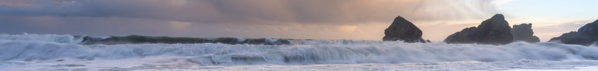
The Temple of Poseidon in Sounion, Greece.
I’m glad I dropped it because I found someone had already created such a script, and it can consume a gigantic Records.json file. It will spit out the GPS data for any date range I want in GPX format. I discovered a Lightroom extension that makes importing that file easy, and it massages the data if a photo is taken in between points too.
The conversion script is a Python one called location-history-json-converter that can be found here. It’s relatively easy to install on Linux or macOS. If you use Windows you hopefully know how to get Python installed.
Once installed, I ran the following command to extract the GPS data I wanted for the first 17 days of May this year, and output it in the GPX format.
That produced a nice 1.3MB file from the huge Records.json file.
The Maps module in Lightroom does allow you to import tracklogs, but I’ve used it in the past, and sometimes it missed photos, maybe because my tracklog wasn’t recording points often enough. This time I used Jeffrey Friedl’s geoencoding extension for Lightroom. The ability to adjust the timezone was critical to me, as I wanted to geoencode or geotag the photos I took on a recent trip to Greece.
On the metro in Athens, Greece.
I messed up the first time and told it to adjust the timezone by 2 hours, the difference between Ireland and Greece but that was an hour out, possibly because of daylight savings time settings somewhere in the mix of camera, phone and exported data. I was really annoyed with myself over that because the plugin allows you to choose only “unmapped photos”, but now every photo was mapped. 75% of them were mapped to the wrong location!
I realised it didn’t matter because the originally geotagged images were tagged off my phone, so they had the same location data as Google Timeline. I went slower a second time, picking a couple of test images of places I knew, and by adjusting the timezone by 3 hours, I saw that it worked perfectly. I ran the job again against more than 1800 images and those images were geotagged correctly.
In the past, I used a GPS logger app to log my location to my phone. That created a GPX file, but I completely forgot I had that installed and simply used the Sony app connected to my camera for a long time. The Google Timeline data is already there because I allow Google to log that data, so it’s a handy source of this information. I can attempt to geotag years worth of photos now, but I’ll have to go slow, as I know the time on my camera drifts, so that will have to be accounted for.
That’s not really an announcement you want to hear from the pilot of your flight, but that’s what happened on my flight from Athens to Amsterdam recently.
The pilot came on the intercom and informed his passengers there was no water to flush the toilets or wash hands. He said that’s the first time he’s had to make such an announcement. The flight had been delayed an hour at Athens, and then we spent 25 minutes on the ground while the congested air over Europe cleared. So I’m surprised someone forgot to fill the water tank.
Water bottles were provided, but I think everyone was glad to get to Amsterdam, even if several people missed their connection due to delays. Thankfully, the flight to Cork was late in the evening, and I had time to make it to gate D6. The airport was mostly closed down with only a few shops open, and passport control was backwards which was odd but worked well enough to get us to our destination. The police there were friendly and efficient.
I have to say, one thing I love about KLM is their free WiFi that allows messaging on WhatsApp, Messenger and other apps. It was great to message my family and friends while flying. It’s something that will make me choose KLM for a connection if all other things are equal. The flight to Cork didn’t have it, but the outgoing flight a week earlier did.
I was watching Top Gun: Maverick on my phone, downloaded on the Netflix client, and it looked like my flight would land before the film ended.
It was a late flight, the lights switched off in the cabin. I was staring at the action on my phone, with headphones hiding the drone of the aircraft. I was glued to the action on my phone, totally absorbed in it. Maverick shouts at his passenger, “Hang on. We gotta get low.” during a dogfight. A moment later, I feel my flight touching down on the runway at Cork Airport, and I look up in mild panic. Talk about immersion. Thanks, KLM! Perfect timing!
If you live north of me in Europe, there’s a pretty good chance you’ll see an aurora tonight. I’m looking forward to seeing all the photos!
The US Space Weather Prediction Center has issued its first “severe geomagnetic storm watch” today for the first time in nearly 20 years.
The activity is expected to make the aurora borealis phenomenon visible across Northern Europe in the early hours of Saturday, May 11th (after midnight tonight).
Thanks to this Hackaday article, I found a video describing how to use Visual Studio Code to write 6502 assembler for the Commodore 64!
It’s been a long time since I’ve done any ASM on the C64, and compared to the programming environments available these days, I was working in the dark ages with my Action Replay monitor, typing code directly into memory.
Kick Assembler is used to assemble the code into a .prg file, using the KickAss (C64) extension for VS Code to launch the emulator with the code loaded into memory. I see Kick Assembler 8-Bit Retro Studio is mentioned in the comments, and it is indeed still being developed, so it might be the better choice, but either will make developing on the C64 much simpler.
It gives a nice overview of using Git to track changes too, something I would have also loved on the C64. So many files prefixed with numbers as I experimented with effects …
Close
Ad-blocker not detected
Consider installing a browser extension that blocks ads and other malicious scripts in your browser to protect your privacy and security. Here are a few options.
uBlock Origin is a free, open source, ad blocker for your browser.
Use pi-hole if you have a spare Raspberry Pi on your network.
Set the private DNS settings on your phone to dns.adguard.com to block adverts and trackers.